
Platform
The platform offers an open API and modular feature design you can use as needed—from creating projects, uploading maps, and deploying beacons to viewing real-time locations and alerts—building your own positioning system in just 5 free steps.
Build a Positioning System Yourself in 5 Free Steps
No coding required—configure step by step with guidance to get a working positioning system.
1 · Create Project
Add a project and create buildings and floors.
2 · Upload Map
Create floors for each building and upload and match 2D or 3D maps to them.
3 · Deploy Beacons
Plan and place positioning beacons on the map, and set beacon adjacency relationships.
4 · Create Personnel & Assets
Create personnel, vehicles, or assets, and bind positioning terminals or beacons.
5 · View & Operate
View real-time locations online and perform various management and operations.
Modular Platform Capabilities
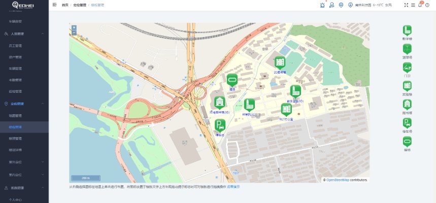
Create Project
After the project administrator creates a project, buildings are created at the project site as organizational units for subsequent maps and beacons.
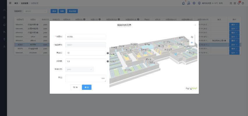
Upload Map
Create floors for each building and upload and match 2D or 3D maps, making location visualization more intuitive.
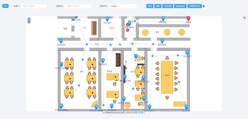
Deploy Beacons
Place positioning beacons on the map and set beacon adjacency to provide a reference baseline for indoor positioning.
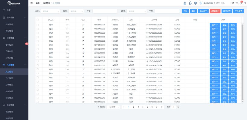
Create Personnel & Assets
Create personnel, vehicles, or assets and bind positioning terminals or beacons for unified management.
View Real-Time Information
View real-time and historical locations, plus business information such as alerts, attendance, and patrols.
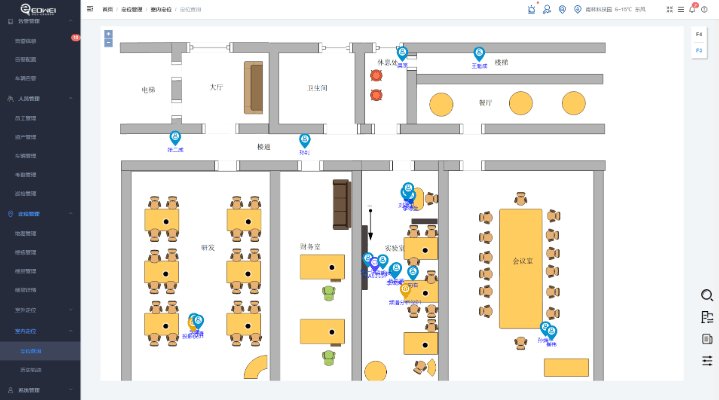
View & Operate
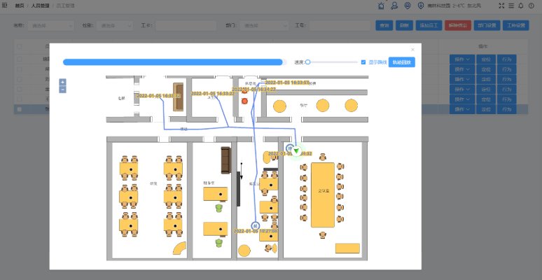
View and replay personnel movement trajectories to trace and analyze work processes.
Data Statistics
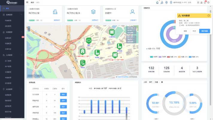
The home dashboard displays real-time personnel and asset information, alerts, and device status per building.
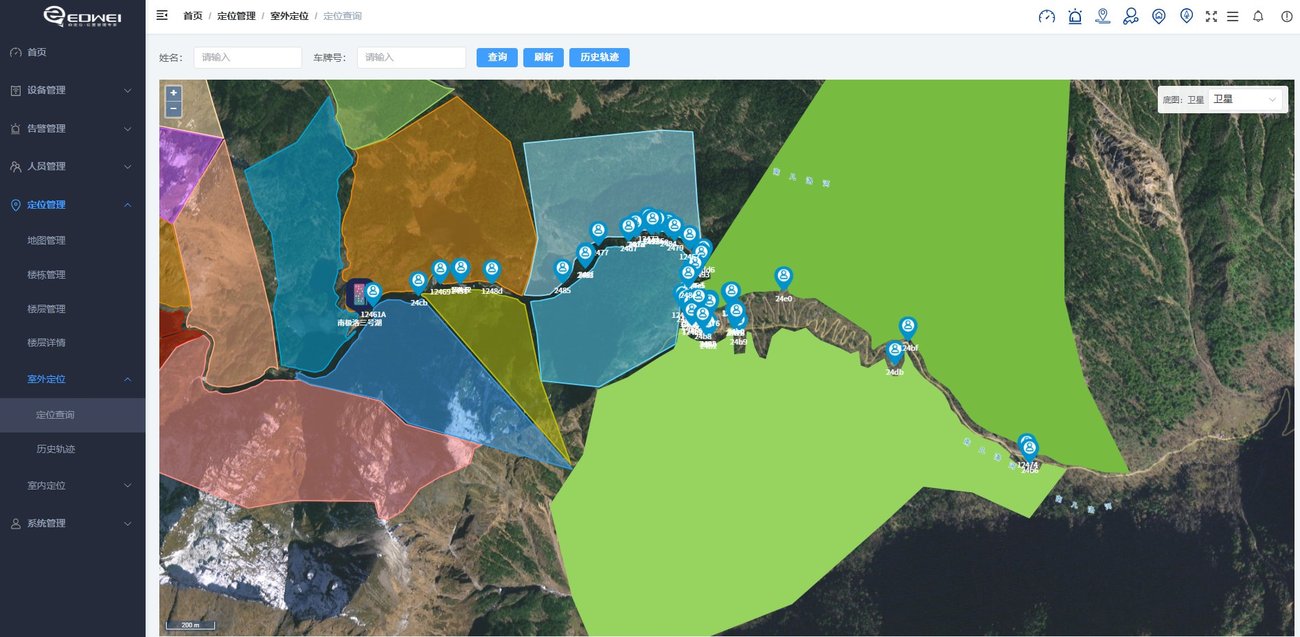
Outdoor Personnel Positioning Deployed at a Scenic Area
The image below is a screenshot from a live project: in the scenic area’s outdoor zone, the satellite map shows the real-time distribution of many personnel, with geofences divided by business area—stable and online even in public-network-free environments such as mountains and valleys.
Want to see what the platform looks like right away?
We provide a public trial account—log in to view real-time positioning, trajectory replay, and the alert center; open API integration with your own systems is also supported.
Try It Now