Outdoor hiking Β· personnel positioning and rescue

Outdoor hiking personnel positioning and rescue system
Camp base station + along-route relay + offline person-finding

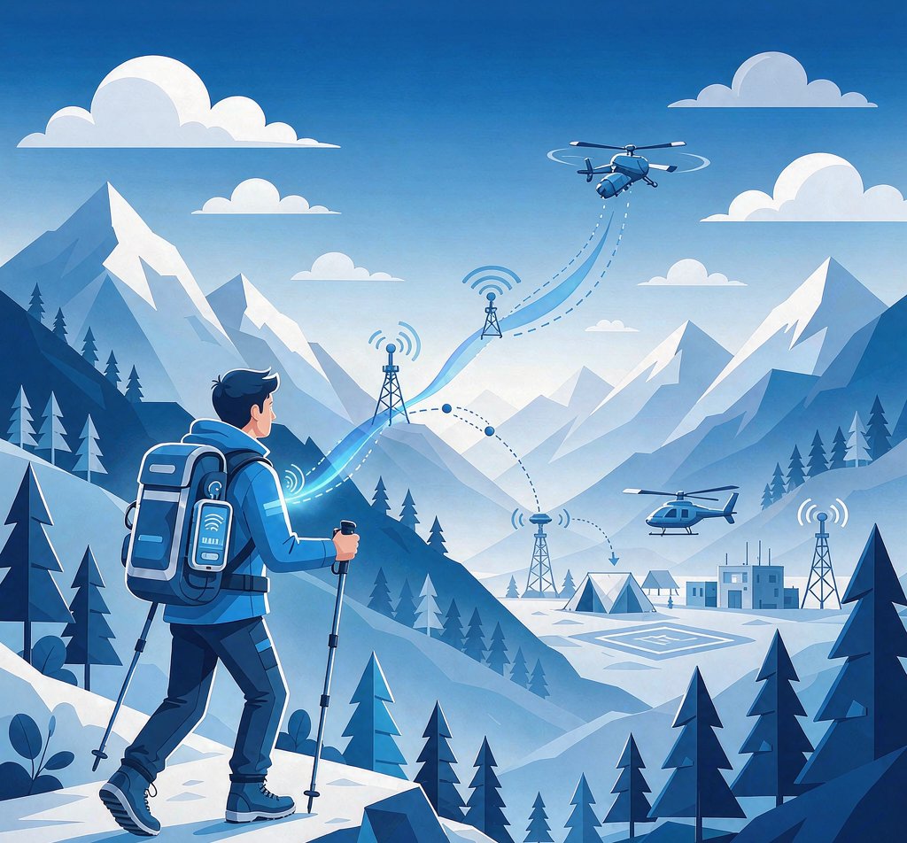
Hiking routes are mostly fixed, but members easily separate and mountains lack signal, making supervision hard. This solution sets up a LoRa base station at camp; personnel wear badge positioning terminals,Deploy one LoRa relay every 2~3 km along the routeForms a signal corridor; once someone exceeds coverage, the team manager or another member with a handheld receiver can view their position offline via phone.
πŸ•οΈ Camp base stationRoute start/end coverage
πŸ“‘ Every 2~3kmAlong-route relay corridor
πŸ“± Offline person-findingHandheld Receiver + Phone
⚑ No data feesLoRa private network backhaul
Outdoor Hiking Personnel Positioning and Rescue - Scenario Diagram
01 / WHY

Hiking activities, why is supervision difficult?

Routes are fixed, but people separate; mountains lack signal, and accidents leave no way to find them

πŸ“΅

No signal throughout

Hiking routes in mountains, canyons, and dense forests lose public network year-round; ordinary phones and locators cannot report, so separated members are immediately "lost."

🧭

Fixed routes still prone to separation

Even with a fixed route, members differ in stamina and pace; forks, night paths, and getting lost easily cause lag, making it hard for leaders to track everyone in real time.

πŸš‘

Missed golden rescue window

When lost, injured, or hypothermic, positioning for help is impossible; search and rescue relies on "shouting across the mountain," time-consuming, laborious, and dangerous.

02 / RELAY CORRIDOR

Core networking: along-route relays form a signal corridor

Camp base station + one relay every 2~3 km turns the "signal-less mountain trail" into a supervised communication corridor

πŸ₯Ύ πŸ₯Ύ πŸ₯Ύ πŸ₯Ύ πŸ“‘ Relay +2km πŸ“‘ Relay +3km πŸ“‘ Relay +2km πŸ•οΈπŸ“‘ Camp Base Station
πŸ’‘ Relay density adjusted to terrain:In open terrain each unit covers about 3 km; in dense mountain obstruction, densify to 2 km or closer; relays are deployed "bead-string" along fixed routes, forming a LoRa signal corridor above the entire trail, with all positions backhauled to camp along the corridor.
03 / INNOVATION

Core innovation: offline person-finding even out of range

Handheld LoRa receiver, can check position nearby even without signal; can also be mounted on a drone for stronger, wider aerial signal

🚁 Aerial Receiver Drone-mounted Β· LoRa Relay πŸ₯Ύ Separated member's badge πŸ“Ÿ Receiver Receives LoRa Β· Pushes to Phone via Bluetooth πŸ“± BLE β†’ Phone 470M LoRa Uplink Aerial Relay Forwarding Bluetooth
πŸ“Ÿ Team rescue device

Handheld LoRa Receiver

When a member leaves the relay corridor and exceeds base station coverage, the team's manager or another member carryingHandheld Receiverβ€” It actively receives LoRa signals from nearby badges, then transmits viaBluetooth (BLE) pushed to phone.

Even in areas entirely without public network, opening the phone App shows the separated teammate'sDirection and distance, trail-following search, quick regrouping or rescue.

🚁 Drone Aerial Relay:The receiver can also be mounted on a drone aloft. High altitude is unobstructed with stronger, wider signal; it can simultaneously receive LoRa signals from multiple separated members and serve asAerial relayForward to ground handheld receiver or phone, greatly expanding search-and-rescue radius and shortening find time.

  • Out-of-range offline person-finding, independent of any public network
  • Covers badge signals within hundreds of meters nearby
  • 🚁 Can be mounted on a drone for ascent, wider aerial signal
  • Same data source and interoperability with camp base station and platform
04 / ARCHITECTURE

System Architecture

Two links β€” real-time camp supervision + out-of-range offline search and rescue, sharing the same LoRa network

Hiking route (no/weak signal) LoRa signal corridor 470MHz Cloud Platform Camp / rescue πŸ₯Ύ Hiking member (wearing badge) πŸ§‘ πŸ§‘ πŸ§‘ πŸ§‘ πŸ§‘ Badge locator Β· timed LoRa position broadcast πŸ“Ÿ Team handheld receiver (drone-mountable) πŸ“Ÿ Receiver Receives LoRa πŸ“± View position via Bluetooth BLE Out-of-range offline search and rescue Β· drone-mountable aerial relay πŸ“‘ LoRa Relay TCS01 Γ— along the route One every 2~3km πŸ•οΈπŸ“‘ Camp Base Station Route start / end Multi-channel aggregation Uplink 470M 4G/Ethernet backhaul ☁️ Outdoor Supervision platform Real-time location of all personnel Geofence / route Separation / boundary-crossing alarm Track Replay SOS one-touch distress πŸ–₯️ Camp big screen πŸ“± Mobile App πŸ”” Alarm Push 🚨 Dispatch rescue Link A: badge β†’ along-route relay β†’ camp base station β†’ platform (real-time supervis Link B: handheld receiver β†’ phone (out-of-range offline search and rescue)
Two links + aerial relay, one network:Within the signal corridor, members' badges relay in real time via along-route relays to the camp platform; all positions and route rules are controlled on screen; once someone leaves the corridor, the handheld receiver carried by the team receives their LoRa signal nearby and pushes via Bluetooth to the phone,Immediate search-and-rescue positioning even without public network; the receiver can also be mounted on a drone aloft, where high altitude is unobstructed with stronger, wider signal, serving as an aerial relay simultaneously receiving multiple separated members' signals and forwarding to ground,Greatly expands search-and-rescue radius.
05 / PRODUCTS

Four Core Hardware

Badge terminal Β· handheld receiver Β· camp base station Β· along-route relay

Hiking personnel badge locator
Personnel side Β· Badge

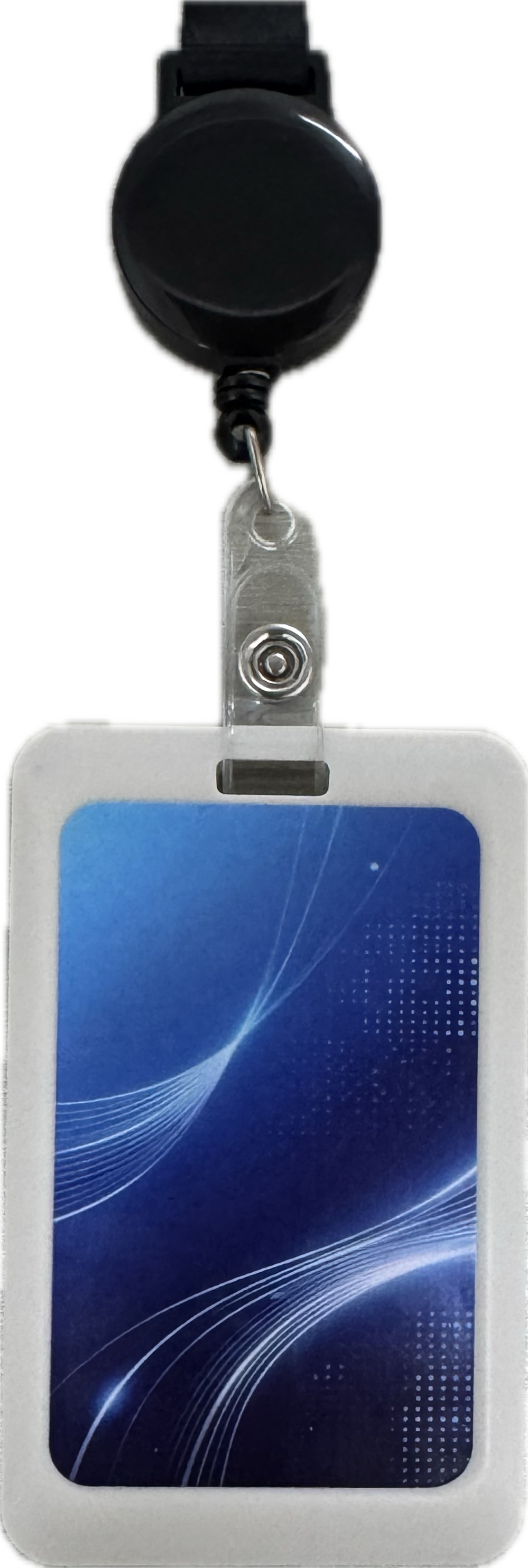
Personnel positioning badge

Member hangs on chest, periodically broadcasts position via LoRa
  • Slim and portable, wear with lanyard
  • GPS/BeiDou positioning + 470M LoRa backhaul
  • Low power and long endurance, worry-free all-day hiking
  • Expandable SOS one-touch distress
  • Waterproof and drop-resistant, field-adapted
Handheld LoRa Receiver
Rescue side Β· find person

Handheld LoRa Receiver

Receives LoRa Β· pushes to phone via Bluetooth Β· drone-mountable for aerial relay
  • Actively receives LoRa signals from surrounding badges
  • Bluetooth BLE pushed to phone App
  • Offline position viewing even without public network
  • Show direction and distance for trail-following search and rescue
  • 🚁 Drone-mountable aloft, wider aerial signal relay
Camp LoRa base station
Camp end Β· aggregation

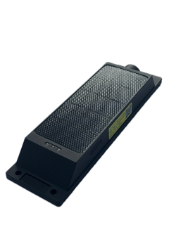
Camp LoRa base station

Mounted at camp, receiving corridor data backhauled to platform
  • Mounted at camp / start-end high points
  • Multi-channel concurrency, whole team access
  • Uplink 470 MHz, free of traffic fees
  • 4G/Ethernet backhaul to cloud platform
  • IP67 protection, field-ready
LoRa Relay TCS01
Link End Β· Relay

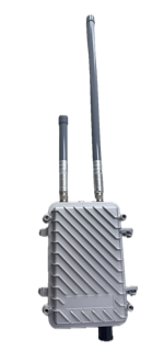
LoRa Relay (TCS01)

Deploy every 2~3km along the route, forming a signal corridor
  • "Bead-string" deployment along fixed routes
  • Signal relay extends full coverage
  • IP67 protection, -20~60℃ wide temperature
  • 3.7V power, low power
  • Denser deployment in mountainous dense areas
06 / PLATFORM

Core Platform Functions

Camp one-screen unified management; phone for on-team rescue

πŸ“

Real-time location of all personnel

Whole-team position on one map, filter by group/individual, fully visible on camp big screen

🧭

Route / fence

Define fixed routes and activity boundaries; real-time alerts on deviation or boundary crossing

🚨

Separation alarm

Member lagging beyond distance or disconnected long auto-detected and pushed to leader

πŸ†˜

SOS one-touch distress

Member presses badge SOS key; platform popup + location, immediate dispatch of rescue

πŸ“œ

Track Replay

Replay any member's historical route for review and search-and-rescue analysis

πŸ“±

Mobile End Linkage

Camp big screen + phone App + handheld receiver, base-field integration

07 / ALERTS

Intelligent Alarm System

Alarm TypeTrigger ConditionLevelDisposition Method
🚨 SOS distressMember presses badge SOS buttonEmergencyPlatform popup + location, immediate nearby rescue
🧭 Route deviationPosition continuously deviates from the planned hiking routeEmergencyRemind the leader to prevent getting lost
πŸ‘₯ Separation / laggingDistance from team exceeds threshold or lag time exceeds limitEmergencyPush location, dispatch someone to meet
🚧 Crossing AlarmEnter no-entry / dangerous area geofenceImportantVoice / platform reminder to guide return
⏸️ Abnormal StillnessProlonged stillness (suspected injury/illness)ImportantOn-site health status verification
πŸ”‹ Low BatteryBadge battery below thresholdNoticeRemind to charge, avoid disconnection
08 / ADVANTAGES

Core Advantages of the Solution

πŸ“Ά

Supervision even without signal

LoRa signal corridor replaces public network, fully manageable in mountainous areas

πŸ“‘

Deploy along the line

One relay every 2~3km on fixed routes, simple and clear deployment

πŸ“±

Out-of-range search and rescue capable

Handheld receiver + phone offline positioning of separated members

🚁

Air-ground coordinated search and rescue

Receiver mounted on drone aloft; aerial relay extends search-and-rescue radius

⚑

Free of traffic fees

LoRa private network backhaul, zero data cost for long-term operation

πŸ›‘οΈ

Safety net

SOS + separation + deviation multi-alerts, safeguarding the golden rescue window

09 / APPLICATIONS

Typical Application Scenarios

πŸ₯Ύ

Outdoor hiking / mountaineering

Team hiking and mountaineering full-process location supervision and search and rescue

πŸ•οΈ

Field camping / team building

Camp perimeter activity-range control to prevent getting lost

πŸ”

Research / patrol

Personnel positioning for uninhabited-area research and forest patrol

πŸƒ

Off-road events

Marathon / off-road race participant tracking and safety

Share this page by scanning with WeChat
QR Code of this page
QQ Weibo Copy Link